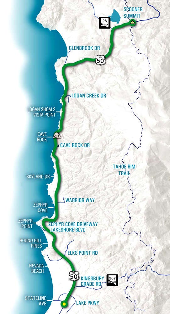
Project Location
The 13-mile study limits span US 50 in Lake Tahoe’s East Shore, from Spooner Summit in the north to the California state line in the south. The study limits are located entirely in Douglas County, Nevada. This corridor is unique given the broad range of users compared to other corridors around the Tahoe Basin. These users include:
- Residents
- Commuters
- Visitors/Recreationalists
- Local and Regional Commerce
- Inter-State Travelers
U.S. 50 CMP Study Limits
- Northern Terminus: Spooner Summit
- Southern Terminus: CA State Line
- Total Length: 13 miles